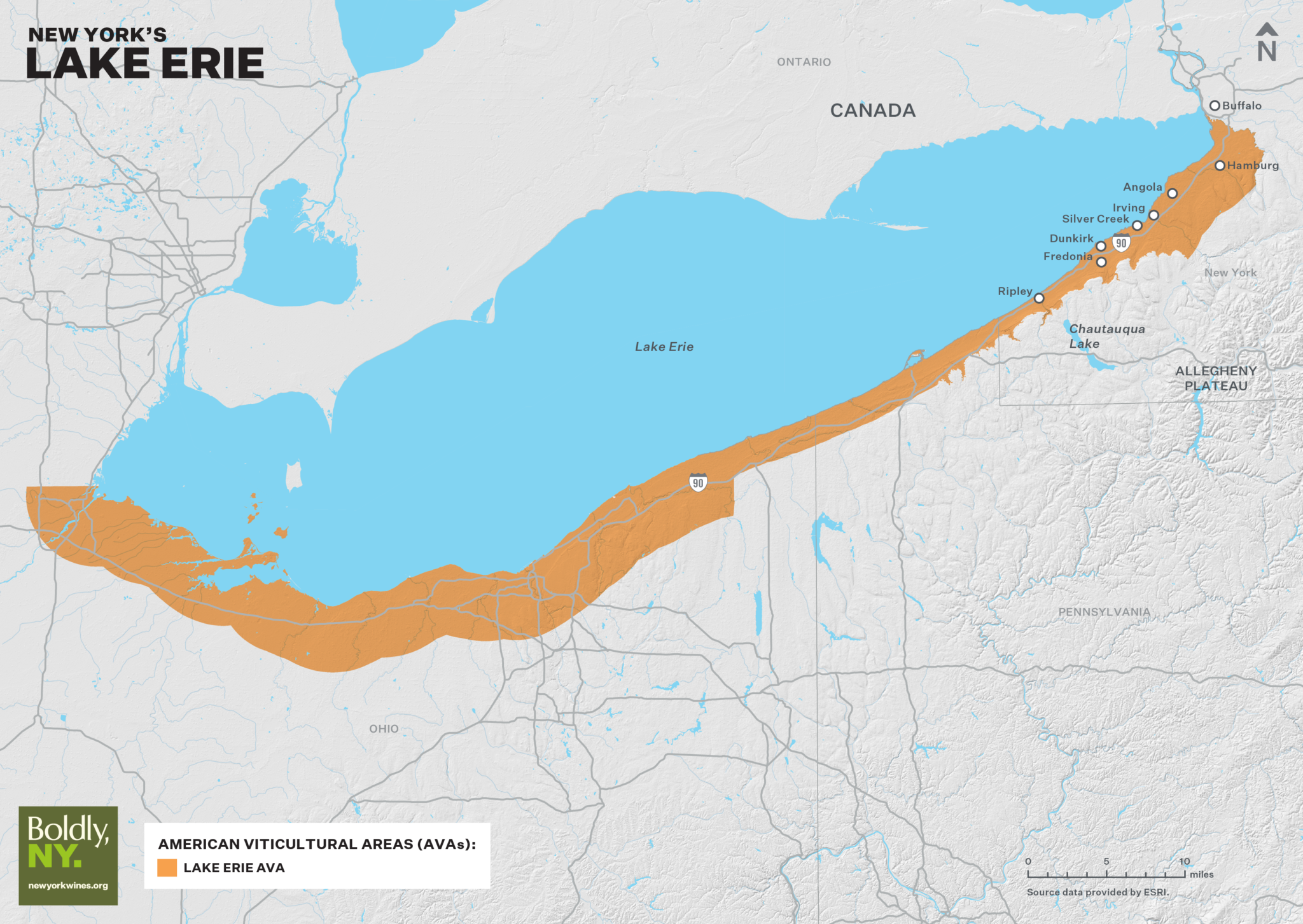
The Lake Erie AVA occupies a narrow strip of well-drained, warm soil running 14 miles along the southern shore of Lake Erie. In its entirety, the 53 mile grape belt spans the states of Ohio, Pennsylvania and New York. The lake itself moderates the climate, and the Lake Erie Escarpment (part of the Allegheny Plateau) provides protection. The effects of the lake and landscape extend the growing season with warmer autumn temperatures that prolong ripening, and cooler spring temperatures that prevent early bud break and subsequent frost damage.

This sprawling grape belt includes 338 vineyards and accounts for 54% of the total vineyard acreage in the state.

Lake Erie Wine Country is a regional wine trail association of 23 wineries that lie from Silver Creek, NY to Harborcreek, PA. There are 11 wineries in the New York State portion of the Lake Erie wine trail.

Geology

The Lake Erie AVA lies within the Lake Erie Lacustrine Plain that borders Lakes Erie and extends from Buffalo, NY to Cleveland, OH. It is composed of sediment from a series of proglacial lakes from the last Ice Age. Bedrock consists of upper Devonian shales and sandstones.

Lake Erie is comprised of three basins. The AVA lies in the eastern basin that extends from Buffalo to Erie, PA. Lake Erie is the shallowest of the Great Lakes; this deepest basin has an average depth of 80ft.

The Chautauqua Grape Belt is actually a series of two to three belts, created by glacial lake beaches and lake bottom sediments. Heavier, fine clay soils can be found near the lake shore, and the most favorable gravelly loam soils lie 500’-800’ in elevation, and extend up to 10’ deep. They are well drained over the permanent water zone below.

Climate

The region lies on the Ontario-Erie plain, with the shoreline of Lake Erie to the north and the bounding, protective crest of the Allegheny Plateau to the south.

The growing area is protected from start of season frosts from the proximity of the cooler lake, and the growing season is extended by the warmer lake as you enter into fall.

The region is sheltered to the northwest by the effect of the Great Lakes Superior and Huron, and by reach of Lake Erie. Data from the Lake Erie Regional Grape Program shows that the annual GDD averages ~3,000.

The temperature effects of regional physiography diminish as you increase distance from the lakes and climb higher on the slopes of the plateau. In extremely cold winters, 80% of the lake can freeze over, leaving vineyards exposed to winter damage.

Quick Facts

About the Lake Erie Region

Region map

Visit Wine Trails in the Region

logo for lake erie wine country